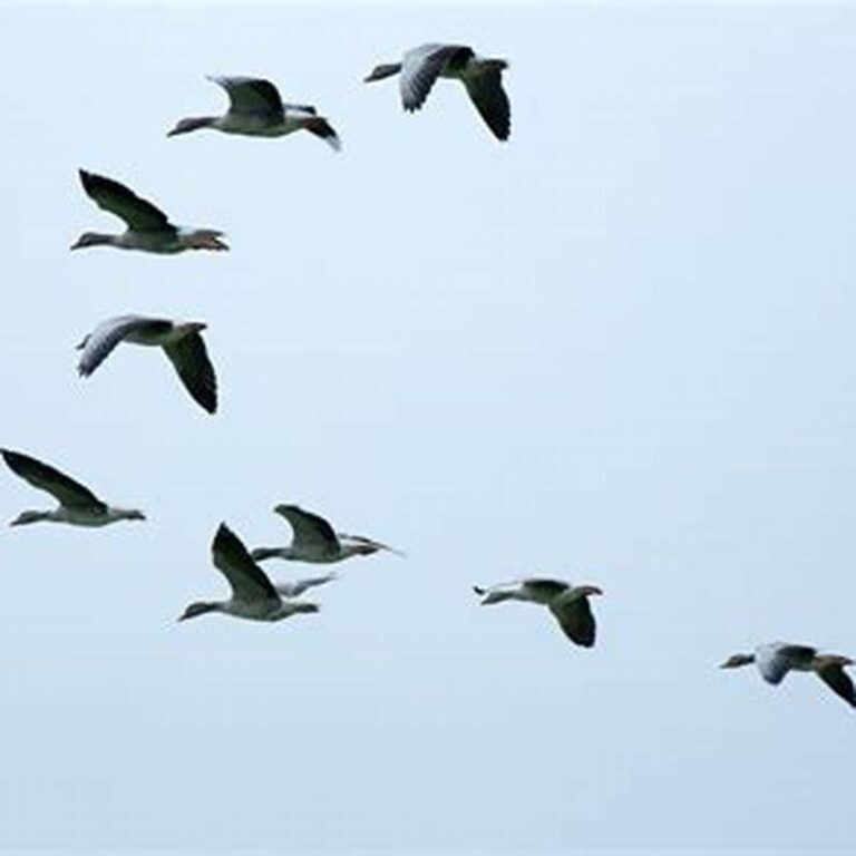
How To Track Bird Migration: Easy Guide For Beginners
Introduction
You can track bird migration in the United States by combining eBird sightings, weather radar, bird-banding records, radio-telemetry data, and local field observations. The best method depends on your goal. Use BirdCast to see broad migration movement, eBird to find birds near you, and careful field notes to confirm what you observe.
Migration is not one event that moves across the whole country at the same speed. Birds respond to weather, food, daylight, wind, geography, and their own life cycle. A good tracking plan uses more than one source.
What Bird Migration Tracking Means
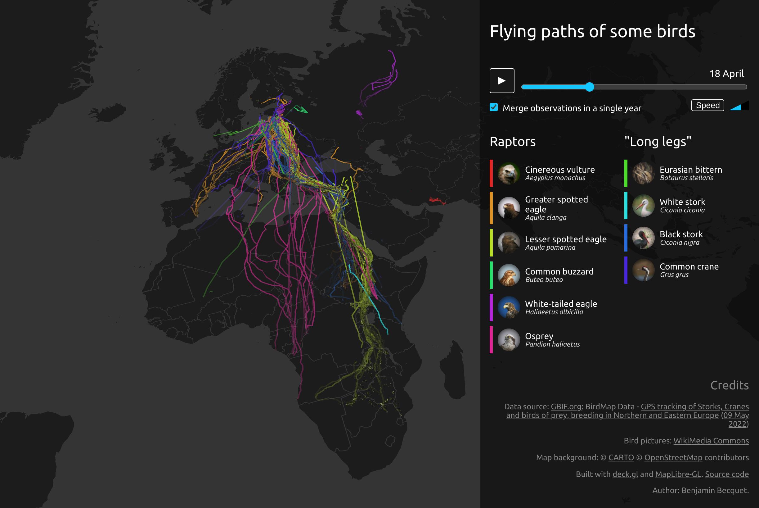
Bird migration tracking is the process of following where birds move, when they move, and how they use stopover sites. A stopover site is a place where birds rest and feed during a journey.
Scientists and birders track migration at different scales:
- Continental scale: Weather radar and large data projects show broad movement across the United States.
- Regional scale: Bird observatories and local reports show which species are passing through an area.
- Individual scale: Bands, GPS tags, and radio transmitters follow one bird or a small group.
- Personal scale: Field notes, photographs, and eBird checklists record what you see.
No single tool shows the full picture. Radar may show birds in the air but cannot identify every species. A checklist may identify a species but show only one small place and time.
The Best Ways to Track Bird Migration
The most useful approach is to match the tool to the question you want to answer.
| Your goal | Best starting tool | What it can show |
|---|---|---|
| Find birds near you | eBird Explore | Recent sightings, hotspots, and species lists |
| See large migration waves | BirdCast and weather radar | Night flight intensity and movement |
| Track a tagged bird | Motus or project maps | Locations from radio-tag detections |
| Study one bird | Banding or GPS data | Movement, survival, and return patterns |
| Watch migration outdoors | Local forecasts and field notes | Timing, behavior, and habitat use |
Start with public data before buying equipment. Most people can learn a great deal with a phone, binoculars, a notebook, and free online tools.
How to Use eBird to Track Migration
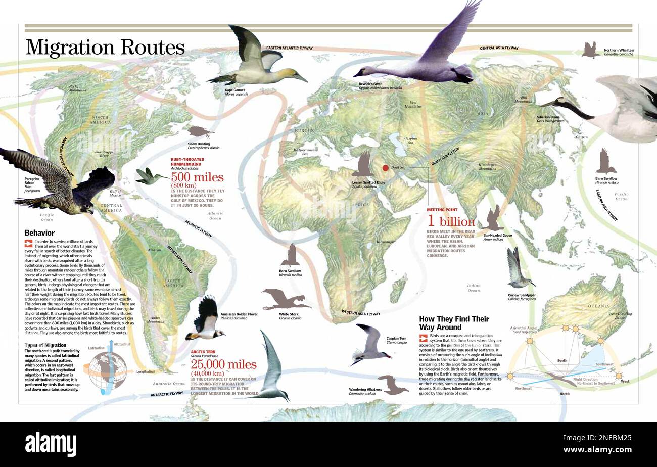
eBird is one of the easiest ways to track migration in the United States. It uses checklists submitted by birders and makes those records available through maps, charts, and hotspot pages.
1. Choose a target species
Pick one bird or a small group of birds. Good choices include:
- Ruby-throated Hummingbird
- Baltimore Oriole
- Swainson’s Thrush
- Yellow Warbler
- American Redstart
- Broad-winged Hawk
- Sandhill Crane
A target species gives your search a clear purpose. It also helps you learn the bird’s call, habitat, and usual migration dates.
2. Open the species map
Use the eBird Explore tools to view records for your target species. Set the map to the United States or to a smaller area, such as a state, county, or migration route.
Check:
- The date range
- The map location
- The number of reports
- Whether the reports are recent
- Whether the records come from many observers or one site
A sighting map shows reported observations, not every bird in the area. A blank area may mean few birds are present, but it may also mean few people submitted checklists.
3. Look at frequency and abundance
eBird charts can help show when a species is usually present. Two terms matter:
- Frequency: The share of checklists that include the species.
- Abundance: The number of birds reported, often adjusted by effort or checklist data.
A rise in frequency can suggest that migration is reaching your area. A rise in abundance may suggest a stronger movement or a good local stopover.
Do not treat either measure as a perfect count. Weather, observer skill, habitat access, and reporting effort can change the pattern.
4. Check nearby hotspots
Hotspots are public birding locations with many submitted checklists. They can help you find birds during migration, especially near:
- Wetlands
- Rivers and lake shores
- Forest edges
- City parks
- Coastal islands
- Wildlife refuges
- Mountain passes
Sort recent observations by date. A report from last spring may show that a site is useful, but it does not prove that the same species is there today.
5. Submit your own checklist
Record every bird you identify during a defined visit. Include:
- Date
- Start and end time
- Exact location
- Number of observers
- Distance traveled
- Birding conditions
- Species and counts
- Whether the bird was seen or heard
A complete checklist is more useful than a list of only unusual birds. If you are unsure of an identification, use an unknown entry or leave it out rather than guessing.

How to Use BirdCast and Weather Radar
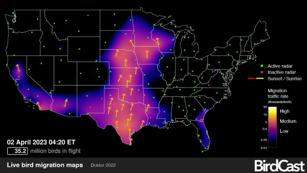
BirdCast uses weather radar, bird observations, and other data to show broad patterns of nocturnal bird migration. It is especially useful during spring and fall, when many songbirds travel at night.
What BirdCast can show
BirdCast tools may help you view:
- Forecast migration intensity
- Bird movement over a region
- Estimated numbers of birds in flight
- Past migration patterns
- Local migration alerts in selected areas
Radar detects biological targets in the air. It can often show when birds are moving, but radar alone usually cannot tell you the exact species.
How to read a migration forecast
Before a birding trip, check the forecast for your area. A strong migration night often has:
- Suitable winds
- Mild temperatures
- Clear or partly clear conditions
- A large number of birds ready to move
A forecast is not a guarantee. Birds may delay migration because of rain, strong headwinds, cold air, or poor visibility.
The best time to look for grounded migrants is often the morning after a strong movement. Search trees, shrubs, and edges near food and water. Migrating birds may stop to rest after a night flight.
How to use NEXRAD radar
The National Weather Service operates NEXRAD weather radar across the United States. During migration, radar may show circular or expanding patterns caused by birds leaving a roost. These patterns can also include insects, bats, or weather.
To interpret radar more carefully:
- Check the radar near sunset and after dark.
- Watch for movement that begins when weather is calm.
- Compare the radar image with wind direction.
- Look for broad movement rather than a small storm cell.
- Check the next morning for birds on the ground.
- Compare the event with eBird reports.
Radar data can support a migration theory, but it does not replace field identification.
Why weather matters
Wind can help or hinder migration. Birds may use tailwinds to save energy and wait for better conditions when winds are strong or unfavorable.
Weather effects vary by species and route. A weather pattern that helps a bird cross the Gulf Coast may not affect a bird moving through the Great Plains in the same way.

How to Track Birds With Banding Data
Bird banding helps scientists identify individual birds and learn where they move. A band is a small ring placed on a bird’s leg under an approved research or monitoring program.
Some birds also carry:
- Color bands
- Wing tags
- Neck collars
- PIT tags
- GPS devices
- Geolocators
- Radio transmitters
If you find a banded bird, do not try to catch it. Record the details from a safe distance and report the band through the official band-reporting system operated by the U.S. Geological Survey and the North American Bird Banding Program.
Useful details include:
- Band color
- Band number, if readable
- Bird species
- Date and time
- Exact location
- Photos
- Whether the bird was alive, injured, or deceased
A partial number or clear photo can still help. Never handle a bird just to read its band. If the bird is injured, contact a licensed wildlife rehabilitator rather than attempting treatment yourself.
Banding data have limits. A recovery shows that a bird was detected at two points, but it does not show every stop along the route.

How Motus Radio Tracking Works
The Motus Wildlife Tracking System uses small radio tags and automated receiving stations. When a tagged bird comes within range of a station, the station records the tag signal.
Motus can reveal:
- Migration routes
- Stopover locations
- Travel timing
- Night and day movement
- Connections between breeding and wintering areas
The system is useful because a tagged bird does not need to be seen by a person. However, detection depends on the tag, station range, battery life, antenna setup, and local terrain.
You can use public Motus maps to explore tagged-animal projects. Look for projects in your region, then check:
- The species involved
- The tag type
- The project dates
- The receiver locations
- Whether the map shows raw detections or cleaned tracks
A radio detection means the tag signal reached a receiver. It does not always prove that the bird stayed at that exact point for a long period.
How to Track Migration in the Field
Online data can guide you, but field observation confirms what is happening on the ground.
Choose the right habitat
During migration, search places with food, cover, and water. Productive sites often include:
- Native trees with insects
- Berry-producing shrubs
- Marsh edges
- Mudflats
- Shorelines
- Riparian corridors
- Sheltered city parks
- Forest openings
Habitat needs change by species. Shorebirds need exposed mud and shallow water. Warblers may use leafy trees. Raptors often gather near ridges and places with rising air.
Visit at the right time
For many songbirds, early morning is the best time to look. Birds may feed actively after a night flight.
Other useful times include:
- Late afternoon before a migration night
- Dawn after a strong radar movement
- Midday at coastal or wetland stopovers
- Clear days with visible raptor movement
Keep visits consistent if you want to compare data. A 20-minute visit and a three-hour visit should not be treated as equal evidence.
Record effort as well as birds
A useful field note might say:
May 8, 2025, 6:30–7:15 a.m.; 1 observer; 0.5-mile loop; cloudy; light southwest wind; 24 species; 6 warbler species.
This record gives future readers context. It also helps you compare one migration day with another.
Watch for signs of migration
Common signs include:
- A sudden increase in bird diversity
- Birds feeding in tree canopies
- Mixed flocks of warblers and vireos
- Large numbers of swallows over water
- Raptors moving along ridges
- Shorebirds appearing after high winds
- Birds calling overhead at night
Bird calls can help detect birds that stay hidden. Learn one or two common calls at a time. Do not play loud recordings near birds, especially during nesting or migration stopovers.

A Simple Bird Migration Tracking Plan
Use this four-part plan if you are new to migration tracking.
Before you go
- Choose one location.
- Select three to five target species.
- Check recent eBird reports.
- Review the BirdCast or weather forecast.
- Learn the target birds’ calls.
- Bring binoculars, a phone, water, and a notebook.
During the visit
- Start at the same time each visit.
- Move slowly through suitable habitat.
- Record every species you can identify.
- Note behavior, habitat, and flock size.
- Avoid flushing birds.
- Photograph birds only when it does not disturb them.
After the visit
- Submit a complete eBird checklist.
- Mark uncertain records for later review.
- Compare your results with nearby checklists.
- Check radar and wind conditions.
- Save your notes in one file or notebook.
Over several weeks
Look for changes in:
- First arrival dates
- Peak numbers
- Species turnover
- Habitat use
- Weather linked to movement
- Departure dates
One observation is a clue. A repeated pattern is stronger evidence.

How to Tell if Your Tracking Is Working
Your tracking method is working when you can answer clear questions with less guesswork.
For example:
- Did migration begin earlier this year at my site?
- Which weather conditions bring the most birds?
- Which habitat holds birds after a major movement?
- Does a species pass through for a few days or several weeks?
- Are my records consistent enough to compare?
Use the same site, visit length, and basic search route when possible. This reduces the effect of changing effort.
A simple comparison can help. Suppose you visit a park for 30 minutes on four spring mornings and record 12, 18, 25, and 16 species. The highest count may reflect a migration wave, but it could also reflect better visibility or a more skilled observer. Compare weather, time, and effort before drawing a firm conclusion.
Common Mistakes When Tracking Bird Migration
Treating one sighting as a migration trend
One bird proves that the species was present. It does not prove that migration has peaked or that many birds are moving through the region.
Using old reports as current evidence
A hotspot may be excellent in April but quiet in June. Always check the date of a report.
Assuming radar identifies species
Radar can show movement, but it usually cannot identify a warbler, thrush, or shorebird. Use field records and acoustic tools for species-level evidence.
Ignoring observer effort
A site with many reports may simply have more birders. Compare checklist numbers, visit length, and coverage.
Overlooking common birds
Common species can reveal migration timing. Large movements of swallows, sparrows, blackbirds, or robins may be meaningful even when they are not rare.
Disturbing birds for a better view
Do not chase, corner, bait, or handle wild birds. Keep a respectful distance, stay on marked paths, and follow refuge rules.
Confusing migration with local movement
Birds may shift between nearby feeding sites without beginning a long migration. Weather, food, water, and predators can cause short movements.

What Equipment Do You Need?
You can begin with very little equipment.
Basic setup
- Binoculars
- A field guide or birding app
- Phone or camera
- Notebook
- Weather app
- Comfortable shoes
- Water and sun protection
Helpful upgrades
- A directional microphone
- A spotting scope for distant shorebirds
- A tripod
- A portable battery
- A printed map
- A hand lens for reading bands from a safe distance
Equipment does not replace good timing and careful notes. A simple setup used often is more useful than expensive gear used rarely.
Avoid buying a radio receiver or attempting to tag birds without training, permits, and an approved research project. Bird capture and tagging are regulated activities that require qualified personnel.

Safety and Ethical Limits
Bird tracking should protect both people and wildlife.
Follow these rules:
- Keep away from nests and roosts.
- Do not use playback near nesting birds.
- Do not enter closed areas.
- Follow federal, state, tribal, and local rules.
- Stay on public paths unless you have permission.
- Avoid night travel in unsafe areas.
- Share sensitive locations carefully.
- Never handle a wild bird without proper authorization and training.
Some locations are closed to protect nesting colonies or endangered species. A public map may not show every access restriction, so check the rules for the park, refuge, or wildlife management area before visiting.

Frequently Asked Questions
What is the easiest way to track bird migration?
Use eBird to find recent sightings and BirdCast to check broad migration activity. Then visit a local habitat at dawn and submit a complete checklist.
Can I track bird migration with weather radar?
Yes, but radar gives a broad view. It can show bird-like movement in the air, especially at night, but it usually cannot identify species.
What time of day is best for watching migrating birds?
Early morning is often best for songbirds because many arrive after night flight and begin feeding. Raptors may be easier to see later when rising air develops.
How accurate are bird migration forecasts?
Forecasts are useful guides, not guarantees. Weather, food, geography, and species behavior can change the result. Confirm forecasts with field observations.
Can I track a specific bird?
Sometimes. A band, color mark, GPS tag, or radio tag can identify an individual. Public programs such as Motus may show detections from tagged birds, but coverage is limited.
How do I report a bird band?
Record the band details without disturbing the bird, take a photo if possible, and submit the report through the official U.S. Geological Survey Bird Banding Laboratory reporting system.
Research Sources and Tools
These organizations provide major public resources for tracking birds in the United States:
- eBird from the Cornell Lab of Ornithology
- BirdCast migration tools
- National Weather Service NEXRAD radar
- Motus Wildlife Tracking System
- USGS Bird Banding Laboratory
- North American Bird Conservation Initiative
- National Audubon Society bird migration resources
Use these sources for current maps, project rules, reporting instructions, and regional information. Tools and dashboards can change, so check the source site before relying on a specific feature.

Key Takeaways
- Use eBird to find recent sightings and track local arrival patterns.
- Use BirdCast and NEXRAD radar to watch broad migration movement.
- Use Motus, bands, and tags to study individual birds and routes.
- Visit stopover habitat at dawn, especially after a strong migration night.
- Record date, time, location, effort, weather, and bird numbers.
- Treat forecasts, radar, and single reports as evidence—not proof by themselves.
- Protect birds by avoiding nests, playback, restricted areas, and unnecessary disturbance.
Conclusion
The most reliable way to track bird migration is to combine several small clues. Start with a forecast, check recent eBird reports, visit suitable habitat, and record what you find. Over time, your own checklists can reveal when birds arrive, where they stop, and how weather changes their movement.
Begin with one local site and one target species. A notebook, binoculars, and consistent visits can turn a short morning walk into useful migration data.